Log In

Somerset and Wiltshire

Why come here?

Somerset and Wiltshire form the heart of what is often called Wessex. Wiltshire is a land of gentle chalk hills, wet moors and ancient stone circles. Nowhere else in England are so many megalithic monuments clustered so closely together. Avebury and Stonehenge are the best known, but the landscape between them is dotted with burial mounds, ceremonial paths and sacred springs. A little further on stands the limestone cathedral of Salisbury.


In Somerset, Glastonbury Tor towers above the low-lying countryside. The Tor is a hill that has been associated with the legend of Avalon for centuries. And then, of course, there are the hot springs of Bath, Wells Cathedral and the Cheddar Gorge. Travellers here move through a landscape that is rural and tranquil in nature, yet conceals one of Europe’s richest (pre)histories beneath its surface.

Highlights


Places of Power

Avebury

With a diameter of over 330 metres, Avebury is the largest stone circle in the world. Within the earthen bank lie two smaller circles, and two long stone avenues lead into the hills, towards West Kennet Avenue and The Sanctuary. Nearby lies West Kennet Long Barrow, one of the oldest and largest burial mounds in Great Britain.


Stonehenge

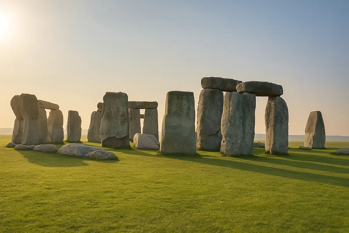
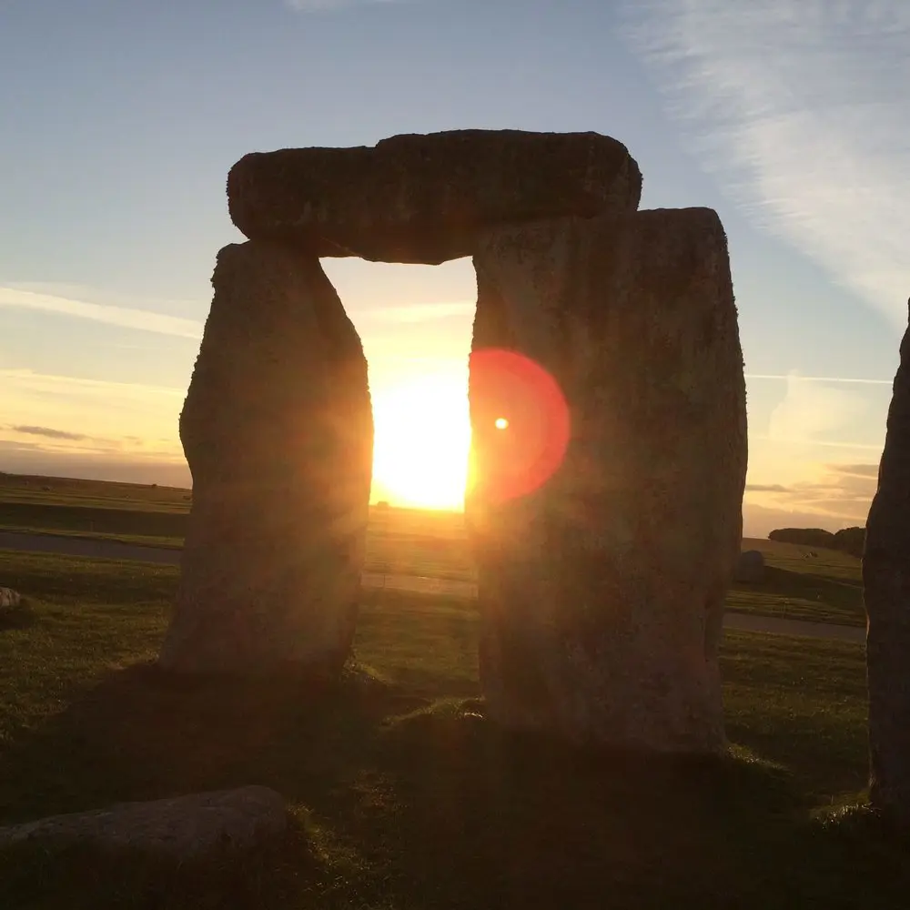
Stonehenge is Europe’s most famous prehistoric monument. The smaller bluestones came from the Preseli Hills in Wales and the large sarsen stones from West Woods near Marlborough, less than twenty-five kilometres away. There are further traces of the same builders in the surrounding area, including the wooden circle of Woodhenge (now concrete posts) and the settlement of Durrington Walls.


Glastonbury

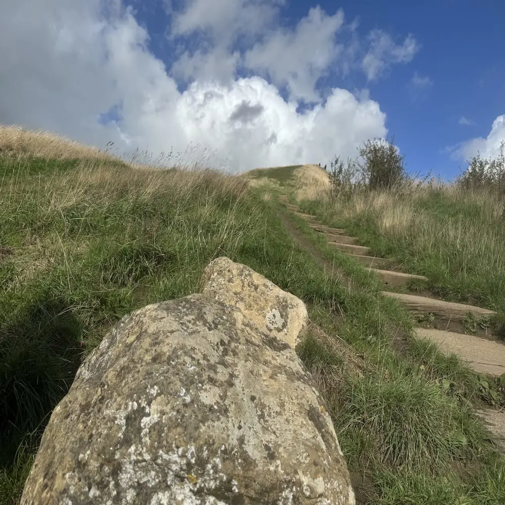
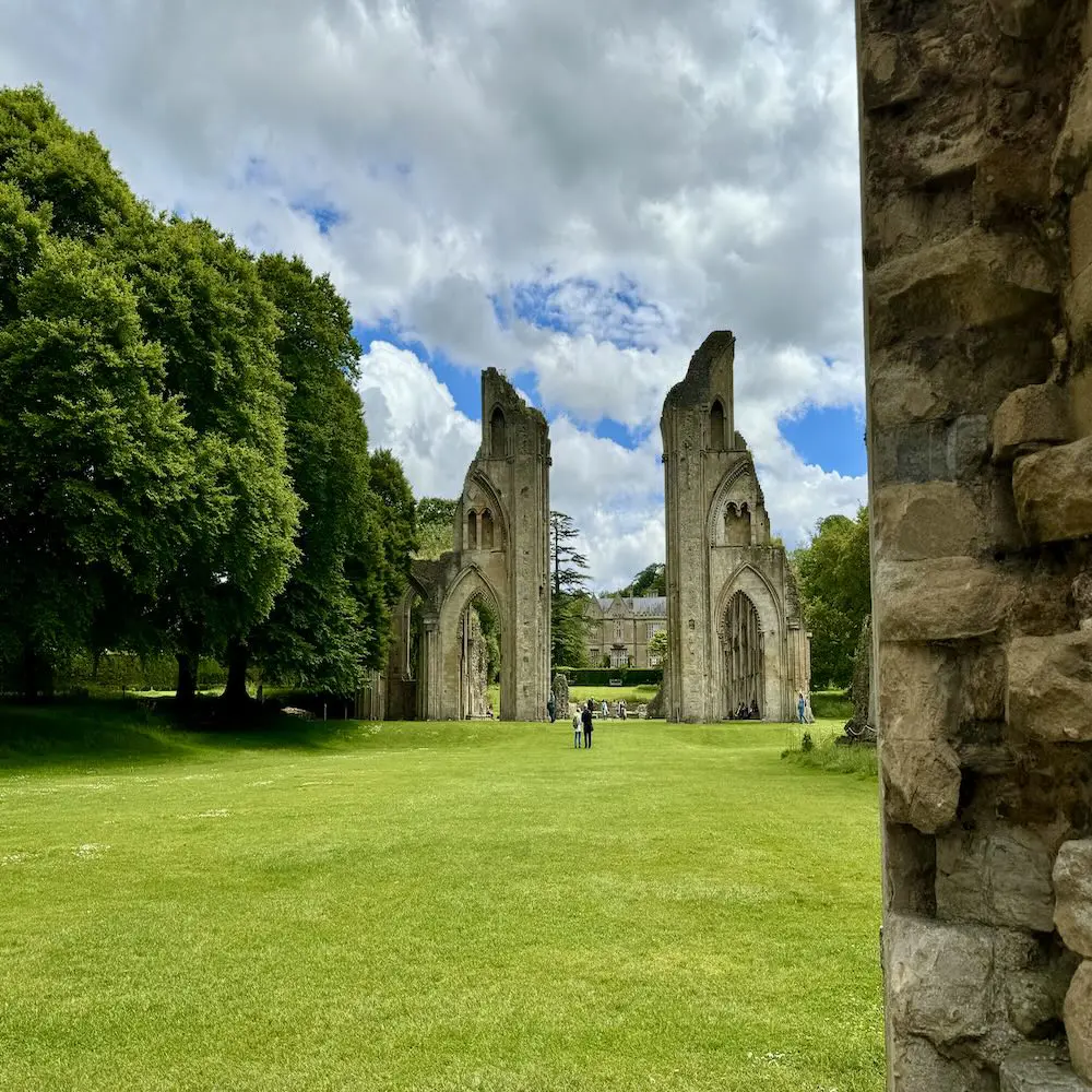
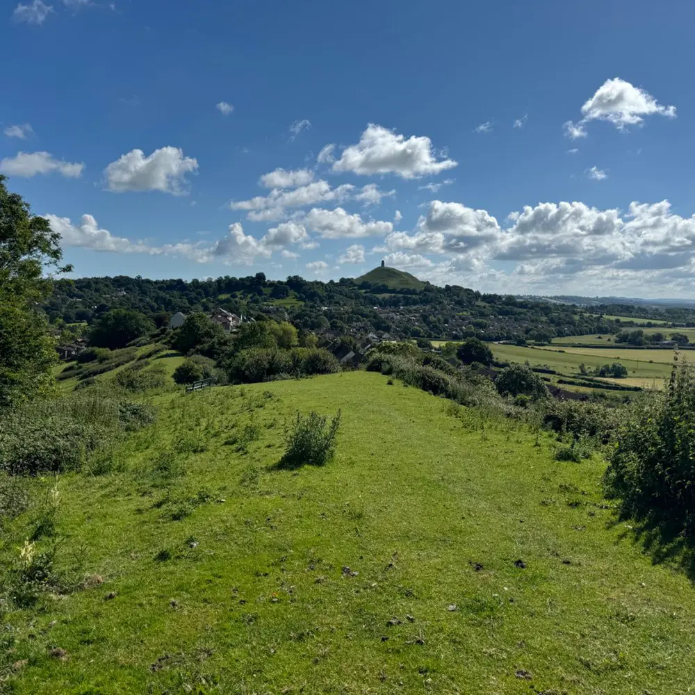
Glastonbury is steeped in the legend of Avalon, King Arthur and Queen Guinevere. On the hill, the Tor, all that remains is a church tower, the remnant of a medieval church. At the foot of the hill, two springs rise right next to each other: the iron-rich Chalice Well and the chalk-rich White Spring. In the town lie the ruins of Glastonbury Abbey, once one of the richest monasteries in England.


South Cadbury Castle

South Cadbury is an Iron Age hillfort which, according to some traditions, is said to have been King Arthur’s Camelot with its famous Round Table. Excavations in the 1960s uncovered the remains of a large wooden hall dating from the fifth or sixth century, along with imported Mediterranean pottery from the same period. This is also the period in which Arthur is said to have lived.


Old Sarum

Old Sarum was the predecessor of the city of Salisbury. This hill was once home to an Iron Age fort, a Norman castle and Salisbury’s first cathedral. In 1220, the inhabitants and clergy moved to the riverbank below, after which Old Sarum gradually fell into disuse.


/bg-704
Magic_stone_Glastonbury_tor

Geology, landscape and nature

Wiltshire lies largely on chalk. This limestone, formed from the shells of microscopic marine organisms, was deposited some 66 to 100 million years ago on the bed of a shallow sea. The chalk forms the rolling plateaus of Salisbury Plain and the Marlborough Downs, with gentle slopes and a porous soil through which rainwater seeps away quickly.
 

This porous nature defines the landscape. There is hardly any surface water on the plateaus themselves, but at the edges of the chalk, the groundwater resurfaces in springs. These chalk springs feed the rivers that flow through the green valleys of Wiltshire, such as the Avon and the Kennet.
 

Somerset has a different character. To the north lie the Mendip Hills, a plateau of older, harder limestone dating from the Carboniferous period, some 300 to 350 million years old. Over millions of years, rainwater has eroded this rock into caves and underground rivers, with Cheddar Gorge being the best-known result.
 

Between the Mendip Hills and the hills of Wessex lies the Somerset Levels, originally a marshy area of clay and peat. Until the major drainage works began in the eighteenth century, the area was often largely under water in winter. Glastonbury was then situated on an island above that marsh, which is the origin of the name ‘Isle of Avalon’.
 

Glastonbury Tor itself is a geological anomaly in this flat landscape. The hill consists of layers of limestone and clay dating from the Early Jurassic, capped by a hard layer of sandstone. This cap erodes much more slowly than the surrounding soil, which is why the Tor has remained as an isolated hill whilst the surrounding area has been worn away. At the foot of the hill, a deep aquifer pushes iron-rich water upwards, forming the spring now known as Chalice Well.
bg-693
Stonehenge_Sarsens_latei

Human history (1)

Prehistory and the megalithic builders

The oldest traces of human presence in this area are not found in stone but in wood. In the Somerset Levels, around 3807 BC, Neolithic farmers built the Sweet Track, a wooden walkway stretching almost two kilometres across the marsh. Dendrochronological analysis has dated its construction to within a year, making the Sweet Track one of the oldest known man-made roads in the world.


From around 3700 BC, the first major ceremonial monuments began to appear in Wiltshire, such as the enclosure on Windmill Hill near Avebury. Shortly afterwards came the long barrows, including West Kennet Long Barrow, built around 3650 BC and one of the largest of its kind in Britain.


Around 2400 BC, Avebury took on its current form, featuring an earthen rampart, a moat and two stone circles within a third, outer circle. Stone avenues connected the monument to other sacred sites, including The Sanctuary and Windmill Hill. Devil’s Den, a nearby dolmen, may also form part of this ‘sacred landscape’. Nearby rose Silbury Hill, which, at almost forty metres, is the largest man-made hill in prehistoric Europe. The purpose of the hill is unknown. What is known, however, is that both The Sanctuary and Windmill Hill are visible from the top of Silbury Hill. It is possible that this played a role in the rituals. In the village, tradition has it that during Beltane, the fertility festivals in the first week of May, the men gathered on Windmill Hill and the women at The Sanctuary. They marched in procession to the central circle where the festivities were held.


The history of Avebury after prehistory is one of decline and restoration. In the Middle Ages, many stones were buried or toppled, presumably because the Church associated them with pagan worship. From the seventeenth century onwards, farmers broke up the remaining stones one by one to use them for building houses and roads. The eighteenth-century antiquarian William Stukeley meticulously mapped the stones during this period and recorded who had destroyed which stone. His drawings remained the only record of the original monument until the marmalade manufacturer Alexander Keiller had the site re-excavated in the 1930s and re-erected many of the fallen stones.


Stonehenge, some thirty kilometres further south, was constructed in phases between approximately 3000 and 2000 BC. The smaller bluestones, quarried as far as 200 kilometres away in the Preseli Hills of Wales, were brought to Wiltshire as early as the very first phase of construction. The large sarsen stones, which form the familiar silhouette, were only traced back to West Woods – a woodland less than fifteen kilometres from the monument – following geochemical analysis in 2020.


In 2024, research into the so-called Altar Stone – the horizontal block at the heart of Stonehenge – revealed a surprise. The chemical composition of the rock did not point to Wales, as had long been assumed, but to the Orcadian Basin in north-eastern Scotland. Further research ruled out the island of Orkney itself as the exact source, but the region around the Moray Firth remains the most likely origin. The fact that the stone was transported over more than seven hundred kilometres points to long-distance contacts between prehistoric communities.


This northern connection fits with an older archaeological pattern. Grooved Ware, the distinctive pottery found at Stonehenge and the nearby settlement of Durrington Walls, is thought to have originated around 3200 BC on the Orkney Islands. From there, the style spread across the whole of Great Britain over the course of a few centuries. Researchers also point to similarities between the floor plans of houses at Durrington Walls and those of the Orkney village of Skara Brae. Taken together, these clues suggest that the northern islands played an important role in the religious and cultural development of southern Great Britain, although the precise nature of that contact remains a subject of research.

bg-693

Human history (2)

From the Iron Age to the Reformation

From around 800 BC, Iron Age communities built fortified hilltops such as Old Sarum and South Cadbury, both of which had been inhabited since the Neolithic period. After the Roman conquest, Old Sarum continued to be used as a trading hub at the junction of several roads. South Cadbury developed into one of the largest hill forts in the south-west.


Under the Romans, the spa town of Aquae Sulis was established near the hot springs of Bath, dedicated to the Celtic goddess Sulis and the Roman goddess Minerva. The baths and the accompanying temple remained in use until the fourth or fifth century. After the Romans’ departure, around the year 410, south-west England was gradually divided between local British rulers and the advancing Anglo-Saxons.


During this turbulent post-Roman period, between approximately 470 and 580, South Cadbury was fortified once more with an extensive rampart and a large wooden hall at the summit. Excavations led by archaeologist Leslie Alcock, between 1966 and 1970, brought this phase to light, along with imported pottery from the Mediterranean region. This evidence of wealth and long-distance trade fuelled the suggestion that this was the seat of a powerful early medieval ruler. This was the period in which the historical figure of Arthur is said to have lived. In some accounts, this fortress is attributed to him and is said to have been the ancient Camelot with the Round Table.


Christianity took root in the area at an early stage. According to the abbey’s own tradition, a church was built in Glastonbury as early as the seventh century, on a site that may have been considered sacred even before that. In the tenth century, under Abbot Dunstan, Glastonbury Abbey grew to become one of the most important monasteries in England.


A fire in 1184 destroyed large parts of the abbey. During its reconstruction in 1191, the monks reported a spectacular discovery: a grave containing two skeletons and a lead cross bearing an inscription stating that King Arthur was buried there, together with his wife Guinevere, on the island of Avalon. The discovery attracted pilgrims and funds for the reconstruction. Historians now regard the discovery as a fabricated tale, possibly encouraged by King Henry II, who had an interest in the idea that the legendary Arthur was definitively dead and buried.


For centuries, Glastonbury Abbey remained one of the richest abbeys in England, with an annual income that surpassed even that of the king himself. This came to an end in 1534, when the Act of Supremacy made Henry VIII the head of the Church of England. The catalyst was his desire to divorce Catherine of Aragon, a request the Pope had refused. Henry broke with Rome and laid the foundations for the Church of England.


Between 1536 and 1541, Henry had virtually all of England’s monasteries dissolved and their possessions confiscated. Glastonbury held out for as long as possible. In 1539, the last abbot, Richard Whiting, was hanged, drawn and beheaded on top of Glastonbury Tor following a show trial for treason, along with two of his monks. The abbey was subsequently plundered and fell into disrepair.


Glastonbury_abbey_graf_grave
bg-688
Avebury_Mary_michael_current

The energy landscape

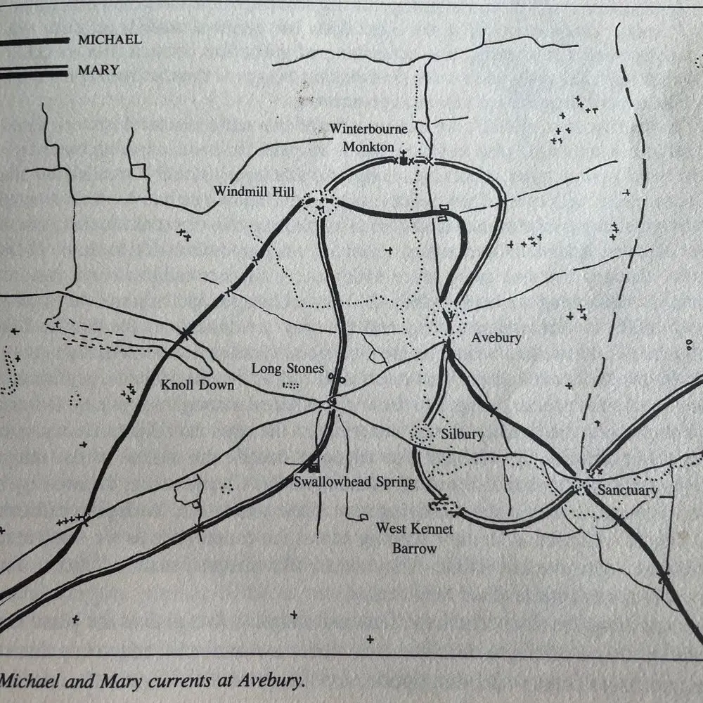
In the 1960s, geomancer and author John Michell discovered that a strikingly straight line runs through the English countryside from Land’s End in Cornwall to the north-east of England. This line, which later became known as the Michael–Mary alignment, connects a large number of significant sites across the landscape. It is oriented towards the sunrise around the first week of May — the time of the Celtic festival of Beltane, which marks the beginning of summer. This moment falls halfway between the vernal equinox (21 March) and the summer solstice (21 June). The word ‘Beltane’ is of Old Celtic (Gaelic) origin and may mean ‘bright fire’ or ‘fire of Bel/Baal’. According to tradition, bonfires were lit on hilltops on this date, including at sites on or near this line. However, this custom was more widespread and not limited to the line itself.
 
 
The energy pathway runs prominently through Somerset (Burrowbridge Mump, Glastonbury) and Wiltshire (Avebury), and this is both visible and palpable. These kinds of ‘major’, often ancient, megalithic sites are almost always indicators of ‘high energy levels’. In this area, they provide an underlying layer of energy that is clearly perceptible. The same applies to areas such as these, which are steeped in stories and legends. The Arthurian legend is, of course, a fine example of this.
 

You can certainly feel the lines, and the divining rod definitely reacts here too. But ultimately, it’s all about the experience at the sites themselves and how they affect you. That’s different for everyone. Follow the tips for each site, open up your ‘senses’ and marvel at the variety of places – and, in all likelihood, the variety of experiences too…
 

Elsewhere on this page, we’ve already mentioned that the megaliths are very likely linked to the peoples of the Orkneys. Hence this tip: do make a point of visiting there too!
Finally, energetically speaking, the landscape is also built up in layers: the primordial layer of the land, then the megaliths, the Celts, the Romans and the Christian era. Focus on the different qualities of each. You’ll find more tips on this in the descriptions of the sites.
bg-688

Burrowbridge Mump

/bg-704

Stories and legends

Drie verhalen keren opvallend vaak terug in de literatuur over dit gebied. Op volgorde van de datum waarop ze voor het eerst zijn opgetekend zijn dat de Dans der Reuzen, de legende van Avalon met koning Arthur en Guinevere, en het verhaal van Joseph van Arimathea met de heilige graal.


De Dans der Reuzen, in het Latijn Chorea Gigantum, komt uit de Historia Regum Britanniae van Geoffrey of Monmouth, geschreven rond 1136. Volgens dit verhaal hadden reuzen de stenen ooit vanuit Afrika naar een berg in Ierland gebracht, vanwege hun helende kracht. Toen koning Aurelius Ambrosius een monument wilde voor gesneuvelde Britten, liet de tovenaar Merlijn de stenen naar Salisbury Plain overbrengen en daar herbouwen tot Stonehenge. Onderzoekers wijzen erop dat het verhaal, hoe fantastisch ook, mogelijk een oude herinnering bevat aan de werkelijke, verre herkomst van de bluestones uit Wales.


De legende van Avalon is nauw verbonden met Glastonbury. Geoffrey of Monmouth introduceerde het eiland Avalon als de plek waar de dodelijk gewonde koning Arthur naartoe werd gebracht. In 1191 verklaarden de monniken van Glastonbury Abbey het graf van Arthur en Guinevere te hebben gevonden, met een inscriptie die Glastonbury voor het eerst met Avalon gelijkstelde. Vóór de grote ontwateringen van de Somerset Levels lag Glastonbury inderdaad als een eiland boven het moeras, wat de identificatie aannemelijk maakte voor middeleeuwse bezoekers.


Het jongste van de drie verhalen gaat over Joseph van Arimathea, de bijbelse figuur die volgens het Evangelie het lichaam van Christus in zijn eigen graf liet leggen. Vanaf de dertiende eeuw raakte hij in Engelse teksten verbonden met Glastonbury, en vanaf de veertiende eeuw werd hij verondersteld er de heilige graal te hebben begraven. Een zestiende-eeuws pamflet voegde er het verhaal aan toe dat Joseph zijn staf in de grond stak op Wearyall Hill, waarna deze uitgroeide tot de Glastonbury Thorn, een meidoorn die twee keer per jaar bloeit. Historisch bewijs voor de aanwezigheid van Joseph van Arimathea in Engeland ontbreekt. Voor de meeste andere verhalen die aan afzonderlijke plekken in het gebied worden verbonden, bestaat evenmin een bevestigde bron.

Holy_thorn_glastonbury
bg-688
hippie_capital_glastonbury

Glastonbury today

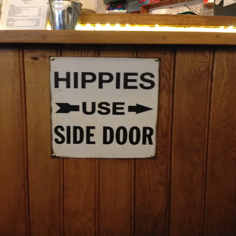
Partly thanks to these stories, Glastonbury developed into a centre for alternative spirituality during the twentieth century. Amongst other things, an order of modern druids, a pagan temple dedicated to the goddess, and groups of Sufis and Hare Krishnas are active in the town, alongside the existing Christian communities. Around May Day, for example, the local Druid order holds a sunrise ceremony on the Tor. These movements are twentieth-century phenomena, arising from a renewed interest in the ancient tales, rather than being an unbroken continuation of a prehistoric tradition. Nevertheless, it remains a particularly fascinating place.
bg-693
white_horse_uk

The white horses of Wiltshire

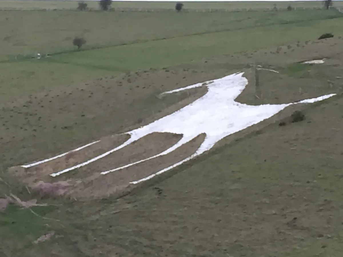
Wiltshire is famous for its white horses, large horse figures carved out of the chalk hills by removing patches of turf. Of the original thirteen or more, eight can now be seen. The oldest is the White Horse of Westbury, which dates back to at least 1742 and took on its present form in 1778. Most of the other horses date from the late eighteenth and nineteenth centuries. With the exception of one – the medieval Uffington Horse in neighbouring Oxfordshire – none of the English chalk horses are actually prehistoric, however ancient they may appear in the landscape.

Unique landscapes and natural sites

The Mendip Hills
The Mendip Hills form an elongated limestone plateau in the north of Somerset, featuring dry valleys, sunken rivers and views over the Somerset Levels at their foot. Alongside Cheddar Gorge, there are numerous lesser-known caves and sinkholes, traces of centuries of karstification.


Cheddar Gorge
Cheddar Gorge, in the Mendip Hills, is the deepest gorge in Great Britain, at over 120 metres. Over the course of around one million years, underground water eroded the limestone to form caves full of stalactites. In one of these caves, Cheddar Man was discovered in 1903; he is the oldest almost complete human skeleton in Great Britain, dating back some ten thousand years.


The Somerset Levels and the Avalon Marshes
The Somerset Levels are a flat, water-rich lowland of clay and peat between the Mendip Hills and the hills of Wessex, which was originally flooded for much of the year. Ditches rather than hedges divide the meadows, and on clear days Glastonbury Tor can be seen rising above the plain from kilometres away. In the area around Glastonbury, known as the Avalon Marshes, old peat extraction pits have been transformed into wetland reserves, where herons, otters and large flocks of starlings spend the winter.


The Sweet Track
The Sweet Track, in the Somerset Levels, is a wooden walkway that was constructed across the marsh around 3807 BC. Dendrochronological analysis has dated its construction to within a year, making the Sweet Track one of the oldest known, precisely dated roads in the world.


The Grey Wethers of Fyfield Down
On Fyfield Down, between Avebury and Marlborough, lies a field full of loose sandstone boulders, traditionally known as ‘grey wethers’ because, from a distance, they resemble grazing sheep. These sarsen stones are the natural source from which the builders of Avebury and Stonehenge quarried their megaliths, and the field gives a good impression of just how vast that stone supply once was.


The Marlborough Downs
The Marlborough Downs form the rolling chalk countryside around Avebury, with sweeping views and the woods of West Woods, from where the sarsen stones for Stonehenge were sourced. The area is part of the North Wessex Downs, featuring ancient beech avenues and chalk grasslands.


The Vale of Pewsey
The Vale of Pewsey cuts through the chalk countryside of Wiltshire like a green, fertile strip. The edges of this valley are where most of the white horses have been carved, visible from the road in the valley itself.


Salisbury Plain
With its unfertilised chalk grasslands, Salisbury Plain is the largest contiguous area of this rare habitat type in north-western Europe. As large sections have served as a military training ground for over a century, the grasslands have remained largely untouched by modern agriculture, boasting a strikingly rich variety of flora and birds such as the curlew.


Cranborne Chase and the West Wiltshire Downs
This rolling chalk landscape to the south of Salisbury Plain is characterised by rounded ridges, wooded valleys and an exceptionally high concentration of archaeological sites. Due to its remote nature, the area is considered to have one of the darkest night skies in southern England.

bg-693

Charming towns and villages

Wells
With a population of fewer than 12,000, Wells is England’s smallest city — a title it owes not to its population but to the presence of a cathedral. The town lies amongst the rolling hills of Somerset, where the Mendip Hills give way to the Somerset Levels, and the cathedral has been the anchor of town life since the twelfth century. The medieval centre around the Cathedral Green is so well preserved that a stroll through it feels like a step back in time. Concentric rings of architectural splendour fan out from the cathedral, including the walled Bishop’s Palace — still the residence of the Bishop of Bath and Wells — where, as is traditional, the swans ring a bell at the gate to be fed.

Salisbury
Salisbury Cathedral was built in an unusually short period — between 1220 and 1258, during the bishopric of Richard Poore, who donated the land on which the cathedral was erected — giving the building a rare, unambiguous early English Gothic style. At 123 metres, the spire is the tallest in the whole of Great Britain, and the cathedral also boasts the largest cloister and the largest cathedral grounds in the country. It also houses the world’s oldest working bell, dating from 1386. The real showpiece, however, is one of the four surviving original copies of the Magna Carta of 1215, preserved in the octagonal Chapter House — considered by experts to be the best-preserved of the four.

Glastonbury
At the foot of the hill with its tower (see the ‘Landscapes’ section) lies the town itself, which has been known for decades as a magnet for those with an interest in the esoteric, artists and pilgrims of all kinds. The streets are lined with shops selling crystals, herbs and spiritual books, and the atmosphere shifts effortlessly between New Age mysticism and the tangible history of the former abbey, once one of the richest in England.


Lacock
Lacock is almost entirely owned by the National Trust and, thanks to its exceptionally well-preserved medieval and early modern architecture, has become a popular film location, including for the Harry Potter films and Downton Abbey. The village is mentioned as early as the Domesday Book and was later laid out in a planned, medieval grid pattern that is still recognisable today. Lacock Abbey was founded in 1232 by Ela, Countess of Salisbury, one of the most powerful women of her time. No TV aerials, no red postboxes, no modern lighting: the village has been deliberately frozen in time, and that is precisely what makes a stroll through it so special.


Bradford-on-Avon
This little town lies in a wooded valley where the River Avon meanders gently through west Wiltshire, with honey-coloured sandstone buildings, ancient bridges and a history stretching back over a thousand years; its crowning glory is the Saxon Church of St Laurence, a small but remarkable late 10th-century building and one of the best-preserved Saxon churches in the country. Not far from there stands the Tithe Barn, which, at fifty-one metres in length, is one of the largest and finest medieval barns in England, originally built to house the tithes of Shaftesbury Abbey. The prosperity of the wool industry is still evident in the stately merchants’ houses lining the river.


Bruton
This former market town in Somerset was long regarded as a sleepy corner of the countryside, until the opening of the Hauser & Wirth art gallery in 2014 changed all that. Since then, Bruton has flourished as a cultural hotspot, with first-class contemporary art, design-focused boutique hotels and quirky shops that have earned the town cult status. The gallery itself is housed at Durslade Farm, featuring five exhibition spaces and a garden designed by the Dutch landscape architect Piet Oudolf. Yet the heart of the town, with its gently sloping streets and old church, has retained its rural character.


Marlborough
Marlborough has one of the widest high streets in England, flanked by black-and-white façades and Georgian merchant’s houses. On the grounds of the renowned Marlborough College lies Merlin’s Mound (also known as the Marlborough Mound), a 19-metre-high hill which, according to legend, is the resting place of the wizard Merlin — the town even bears the motto “Ubi nunc sapientis ossa Merlini”, “where now lie the bones of the wise Merlin”. However, carbon dating has shown that the mound dates back to around 2400 BC, a Neolithic monument from the same period as Stonehenge and Silbury Hill. Just outside the town, a white horse can also be seen carved into the hillside, carved by schoolboys in 1804 to celebrate the 600th anniversary of the town charter. With its chic cafés, narrow alleyways and fortnightly market, Marlborough is both historic and pleasantly lively.


Castle Cary
This golden-stone market town lies tucked away a stone’s throw from the A303, at the foot of Lodge Hill. It is one of Somerset’s most charming market towns, boasting a nineteenth-century Market House, a circular eighteenth-century ‘Roundhouse’ (once a dungeon) and a thatched hotel. The high street, lined with small specialist shops, delicatessens and tea rooms, winds its way down to the old horse pond, and a market is still held there on Tuesdays. Castle Cary is regarded by many festival-goers as the starting point for the route to Glastonbury, and from the top of Lodge Hill you have a sweeping view of the Somerset countryside.

Other highlights

The Ridgeway

The Ridgeway is often referred to as Britain’s oldest road. For at least five thousand years, the route has followed the chalk ridges between Avebury and Ivinghoe Beacon in Buckinghamshire, a distance of nearly 140 kilometres. Since 1973, the route has been an official National Trail, featuring numerous burial mounds and the Iron Age fort of Barbury Castle along the way.


Bath

Bath was founded around Britain’s only natural hot spring. The Romans built a bath complex and a temple to the goddess Sulis Minerva there. In the eighteenth century, the town developed into an elegant spa town with its characteristic buildings made of yellow Bath stone. Since 1987, the entire city centre has been listed as a UNESCO World Heritage Site.


Castles in the area

Somerset is home to several well-preserved castles. Farleigh Hungerford Castle, a 14th-century fortified country house on the River Frome, and the smaller, romantic Nunney Castle are both situated close to Bath and are now managed by English Heritage. Further west, Dunster Castle – of Norman origin but converted into a country house over the centuries – guards the entrance to Exmoor.


Glastonbury Festival

Since its first edition in 1970, which attracted around 1,500 visitors, the Glastonbury Festival has grown to become the world’s largest open-air festival held on a grassy field, now drawing more than 200,000 visitors. The festival takes place at Worthy Farm near Pilton, a few kilometres from Glastonbury itself, and takes a break every fifth year.

Practical tips for your journey

Practical tips for your trip

Driving on the left: just like in Ireland and Cornwall, traffic in England drives on the left-hand side of the road. In Wiltshire and Somerset, too, many country lanes are narrow, with high hedges and the occasional passing place.

Currency: The currency in England is the British pound, and the country is not part of the eurozone. You’ll need to exchange currency or pay contactlessly using an international card.

Staying in a B&B: Bed and breakfasts are an officially recognised form of accommodation, with a quality mark from VisitEngland. Campsites and holiday cottages are just as popular as hotels.

ETA: The United Kingdom is not part of the European Union. A visit requires an ETA declaration, which must be applied for online and in good time. Also check the current requirements regarding the validity of your passport.

Weather and clothing: Somerset and Wiltshire have a mild, changeable continental climate. The Mendip Hills and the hills of Wiltshire receive more rainfall than the lower-lying Somerset Levels. A raincoat should be packed in your luggage whatever the season.

Language: English is the official language throughout the region. Unlike in Cornwall, no distinct regional language has survived here.

Electrical sockets: make sure you have an adaptor for your electrical equipment. The sockets in England are different from those in the Netherlands.